Sarajevo Canton (Kanton Sarajevo)
The Sarajevo Canton, officially the Canton of Sarajevo (Kanton Sarajevo; Sarajevska županija; Сарајевски кантон), is one of 10 cantons of the Federation of Bosnia and Herzegovina in Bosnia and Herzegovina. Its cantonal seat is the city of Sarajevo, also the capital city of Bosnia and Herzegovina.
The Canton represents the metro area of the country's capital city, Sarajevo, together with the City of East Sarajevo. It contains 97% of the city's population, but a much smaller percentage of the official land area. The majority of the population is Bosniak (83,8%).
The history of Sarajevo dates back to Neolithic times, when the Butmir culture made its mountains and hills their home. In ancient times, the Sarajevo area (Canton) was occupied by the Illyrians. The local tribe, the Daesitates, controlled most of the area. They were a warlike bunch and the last Illyrian tribe to resist Roman rule, which finally came in AD 9. Under Roman rule, many roads were constructed in the region, as well as a city on top of modern-day Ilidža. During the Middle Ages, the area of Sarajevo Canton was a key part of the Bosnian Kingdom. The toponym Vrhbosna existed somewhere in the region and was one of the notable settlements at the time.
True development of the region came after the Ottoman conquest when local Muslim noble Isa-Beg Isaković established the roots of the modern city of Sarajevo, between 1461 and 1463. The region grew along with the city, which quickly, after Istanbul, became the most important in the Balkans. Later rule by Austria-Hungary modernized and westernized the region. Under Yugoslavia, there was major development of the area, which more than tripled in size. Because of its ideal geographical location in between mountains, Sarajevo was chosen to host the 1984 Winter Olympics. Much of this progress was offset however by the Yugoslav Wars in the early 1990s.
The Sarajevo Canton was a result of this warfare, created by the Washington Accords in 1994, and its boundaries defined by the Dayton Accords in 1995.
Map - Sarajevo Canton (Kanton Sarajevo)
Map
Country - Bosnia_and_Herzegovina
 |
 |
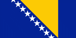
| Flag of Bosnia and Herzegovina | |
The area that is now Bosnia and Herzegovina has been inhabited by humans since at least the Upper Paleolithic, but evidence suggests that during the Neolithic age, permanent human settlements were established, including those that belonged to the Butmir, Kakanj, and Vučedol cultures. After the arrival of the first Indo-Europeans, the area was populated by several Illyrian and Celtic civilizations. Culturally, politically, and socially, the country has a rich and complex history. The ancestors of the South Slavic peoples that populate the area today arrived during the 6th through the 9th century. In the 12th century, the Banate of Bosnia was established; by the 14th century, this had evolved into the Kingdom of Bosnia. In the mid-15th century, it was annexed into the Ottoman Empire, under whose rule it remained until the late 19th century. The Ottomans brought Islam to the region, and altered much of the country's cultural and social outlook.
Currency / Language
| ISO | Currency | Symbol | Significant figures |
|---|---|---|---|
| BAM | Bosnia and Herzegovina convertible mark | KM or КМ | 2 |
| ISO | Language |
|---|---|
| BS | Bosnian language |
| HR | Croatian language |
| SR | Serbian language |


